File:LomaPrieta-Marina.jpeg
Jump to navigation
Jump to search

Size of this preview: 800 × 536 pixels. Other resolutions: 320 × 214 pixels | 640 × 429 pixels | 1,024 × 686 pixels | 1,280 × 857 pixels | 2,904 × 1,945 pixels.
Original file (2,904 × 1,945 pixels, file size: 4.39 MB, MIME type: image/jpeg)
This file and its description are from Wikimedia Commons.
Summary
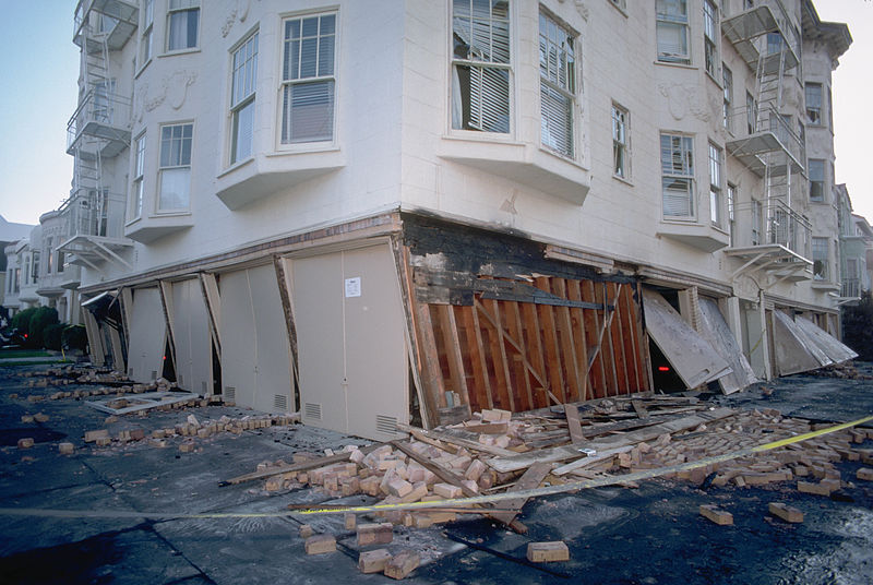
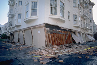
| Description | photograph of a collapsed facade of a building near Beach and Divisadero Streets in San Francisco |
| Date | |
| Source | http://pubs.usgs.gov/dds/dds-29/web_pages/sf.html, http://pubs.usgs.gov/dds/dds-29/tif/img0007.tif |
| Author | J.K. Nakata, United States Geological Survey |
| Permission (Reusing this file) |
"Feel free to use any of these images but please cite the photographer and the U.S. Geological Survey." |
| Other versions | http://pubs.usgs.gov/dds/dds-29/thumbs/007tn.gif |
| This is a retouched picture, which means that it has been digitally altered from its original version.
|
Licensing
This image is in the public domain in the United States because it only contains materials that originally came from the United States Geological Survey, an agency of the United States Department of the Interior. For more information, see the official USGS copyright policy.
|
File history
Click on a date/time to view the file as it appeared at that time.
| Date/Time | Thumbnail | Dimensions | User | Comment | |
|---|---|---|---|---|---|
| current | 18:24, 14 June 2014 | | 2,904 × 1,945 (4.39 MB) | wikimediacommons>Corevette | Higher resolution, adjust levels |
File usage
The following 6 pages use this file: